

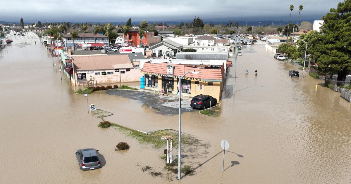
Two strong storm systems are expected to hit the east and west coasts simultaneously beginning Monday as California faces a new threat of flash flooding and heavy snowfall in the mountains.
The arrival of the pair of “separate but powerful” low-pressure systems has left 22 million people under winter weather alerts and will see severe weather hit both sides of the country this week, with widespread precipitation linked to a system throughout the Pacific Northwest. It is expected to move south toward California, the National Weather Service said.
The system, fed by an atmospheric river, is expected to hit the coast in the already storm-plagued state on Monday in Northern California, eventually bringing heavy rain to Central and Southern California on Tuesday. About 17 million people in northern and central California were under a flood watch Monday, with southern parts of the state likely to be added to the flood watch list.
Heavy snow is also forecast for the higher elevations of the Sierra Nevada, the agency said.
Rainfall amounts could reach 6 to 8 inches in parts of the Sierra Nevada foothills and mountains and also in southern California over the next 24 to 72 hours. Snowfall amounts will be up to 4 feet above 7,000 feet and 8 feet above 9,000 feet.
“Significant flooding impacts” are also expected below an elevation of 5,000 feet along the central California coast, the San Joaquin Valley, the Sacramento Valley and the southern Sierra Nevada foothills through Tuesday, it said. .
The areas most likely to experience isolated flooding Monday include Eureka, Redding and Santa Rosa, California.

The weather service further warned that heavy rains and snowmelt could lead to renewed and more widespread flooding, particularly at low elevations.
“Some heavy snowfall further inland across the Intermountain West can also be expected, especially in central Idaho and western Wyoming,” he said.

The latest round of severe weather comes after major flooding over the weekend that saw dozens of people rescued by first responders and the California National Guard, according to The Associated Press.
A video showed a member of the Guard Help a driver get out of a car trapped by water.
California Gov. Gavin Newsom has declared emergencies in a string of counties in recent weeks, and the Biden administration has also promised continued federal support.
Meanwhile, a clipper system moving east across the lower Great Lakes was expected to bring light to moderate snowfall across the Great Lakes before reaching New England on Monday.
“Further south, a wavy front is forecast to bring some severe thunderstorms in the southeast through tonight,” the weather service said.
“This wave is expected to interact with the clipper system moving across the Great Lakes and rapidly intensify into a powerful northeast off the New England coast on Tuesday, bringing heavy snow inland and high winds with rain/ snow near the coast.

Heavy snowfall of up to 2 inches per hour is possible, while strong northeasterly winds could make travel “dangerous or nearly impossible,” the weather service warned. Severe weather conditions could also cause cuts and damage to trees, she said.
Winds will also pick up, with wind gusts to 50 to 60 mph likely, especially along the coast. This could result in blizzard conditions in areas where snow is falling.
Higher elevation areas in the inland Northeast could see more than 12 inches of snow, he said. He further warned that some areas, including the Catskills in New York, the Berkshires in western Massachusetts and the southern Green Mountains in Vermont, could see higher localized snowfall amounts.
“Widespread minor coastal flooding is possible Monday night into Wednesday as low pressure deepens off the New England coast with strong winds likely near Cape Cod later Tuesday,” the service said. meteorological.
On Wednesday, the system will move away from the coast, and morning snow will persist along the New England coast. Winds will remain strong all day across much of the Northeast.


